
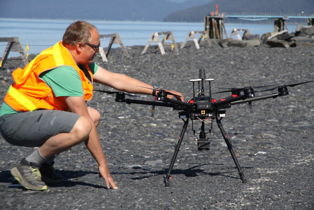
Elevate UAS finished flying its drone over Wrangell last week, taking photos and gathering digital data of the terrain from a pulsing laser aimed at the ground, known as LiDAR. The company was in town to finish the aerial work on its borough contract, which covers almost 1,400 acres from the north end of Wrangell Island to south and east of Heritage Harbor. Andy Dietrick (above) preps the drone for another flight May 19. He and Cole Smith, owner of the Portland-based company, were on their second trip to Wrangell to fly the drone, which has about a four-foot wingspan and weighs 20 pounds before they hang the 2½-pound camera and laser unit on the underside. The remote-controlled drone can stay airborne for 25 to 30 minutes on rechargeable batteries, and flies at just under 14 mph when collecting data, Smith said. The drone constantly checks in with satellites to verify its position as it flies a grid over the area.


Reader Comments(0)